
Greenwich ZIP Codes and What They Cover
Town survey material and official school and polling documents identify five current residential delivery ZIP codes associated with Greenwich: 06807, 06830, 06831, 06870, and 06878. The community names in the middle column are useful clues, not hard postal borders. USPS remains the authority for a deliverable address, while a Town Clerk record, Assessor record, or GIS product supplies a different kind of place evidence.
| ZIP Code | Areas Covered | Post Office | Notes |
|---|---|---|---|
| 06807 | Cos Cob | USPS delivery route, verify by address | Village label in Town school material |
| 06830 | Central or downtown Greenwich and Byram | USPS delivery route, verify by address | Town Hall and civic addresses use this code |
| 06831 | Glenville and northwestern Greenwich | USPS delivery route, verify by address | School and polling sources use this code |
| 06870 | Old Greenwich | USPS delivery route, verify by address | Community remains within the Town |
| 06878 | Riverside and North Mianus | USPS delivery route, verify by address | Community and mailing labels can differ |
| 06836 | Town Hall PO Box and institutional mailing context | PO Box or institutional routing | Not one of the five current residential delivery ZIPs |
The Greenwich resident survey supplies the five-code frequency table. The official school-address PDF and polling-location page provide local examples, but neither creates a comprehensive postal boundary map. A ZIP code directory should therefore state the source and date for every community association rather than imply that a code defines a neighborhood.
Greenwich ZIP Code 06807, Cos Cob
06807 is associated with Cos Cob in Greenwich school-address material and in local historical references. Cos Cob is a community label within the Town, not a separate municipality. A directory or map may use Cos Cob even when a current postal lookup returns Greenwich as the city label. Keep the village name as a separate note, then test the exact house number and street through USPS before assigning the delivery ZIP.
The Cos Cob label is also useful for historical work. Greenwich Library directories and maps can preserve older village or street language that does not match a modern mailing field. When a name is found under Cos Cob, record the directory year and page, then use the Town Clerk land record or GIS request to connect the historical clue to a parcel without assuming that the old ZIP existed at the time.
Greenwich ZIP Code 06830, Central and Byram
06830 appears on Greenwich Town Hall, civic, polling, and other central Greenwich addresses. Byram can use the same ZIP while retaining a separate neighborhood identity. That overlap is a good example of why a ZIP code directory cannot stand in for a community boundary. A record may be legally within Greenwich, socially identified as Byram, and mailed through 06830.
For a 06830 record, keep four values apart: the legal town, the community label, the USPS delivery code, and the parcel or street identifier. A Town Clerk land search uses the property address and legal description, while Assessor and GIS channels add parcel context. A tax-bill result may help match an account, but it does not establish an occupant or title by itself.
Greenwich ZIP Code 06831, Glenville
06831 is used in official school and polling material for Glenville and northwestern Greenwich. Pemberwick and nearby community names may appear in planning or local-history material even when the postal label is Greenwich. Test the street address with USPS rather than treating a neighborhood word as a ZIP search key.
The distinction matters for a resident or parcel query. Use the delivery code to narrow a mailing question, then use the Town Clerk, Assessor, or GIS source for the legal and map layers. If a historical directory lists only Glenville, preserve that wording and date. Do not assign today's ZIP to an old entry without an address-level comparison.
Greenwich ZIP Code 06870, Old Greenwich
06870 is associated with Old Greenwich in Town polling, school, and park material. Old Greenwich remains within the Town of Greenwich, even though the community label is widely used in local life and in address descriptions. A ZIP code search can locate the postal layer, but it cannot decide a town boundary, school assignment, polling district, or parcel relationship.
For an address in 06870, start with USPS, keep Old Greenwich as a community field, and then verify the parcel or legal instrument through the Town's official sources. Historical maps and directories may use a different village or road name. Record both forms when they refer to the same place, and date the result.
Greenwich ZIP Code 06878: Riverside, North Mianus
06878 is tied to Riverside and North Mianus in official school and polling material and in Riverside community information. The association between Riverside and 06878 is useful for finding the right local context, but a community page is not an official resident roster. The postal code and the community boundary answer different questions.
A current delivery check should use the complete street address. A historical check should also test Mianus, Riverside, and older street spellings in the Library's directories and maps. When a record points to a bridge, shoreline, or village edge, GIS can supply a dated map or data product, while USPS remains the source for delivery validation.
Greenwich ZIP Code 06836: PO Box Exception
06836 is the special case in Greenwich postal research. The Town Hall mailing address uses Greenwich, CT 06836-2540, while the street address uses 06830. USPS bulletin material documents routing changes involving 06836 and the delivery ZIPs that now serve Town addresses. The research identifies 06836 as a PO Box or institutional code, not a sixth current residential delivery ZIP.
When 06836 appears on a record, ask what kind of address it represents. It may be a PO Box, an institutional mailing label, or a legacy reference. Do not turn it into a neighborhood assignment. Confirm a street address with USPS and match that street to Town Clerk, Assessor, GIS, or P&Z records.
06836 check. Treat 06836 as a PO Box or institutional mailing clue until USPS or the address custodian confirms a current deliverable street address.
The USPS postal bulletin on Greenwich routing preserves the historical ZIP-change context.
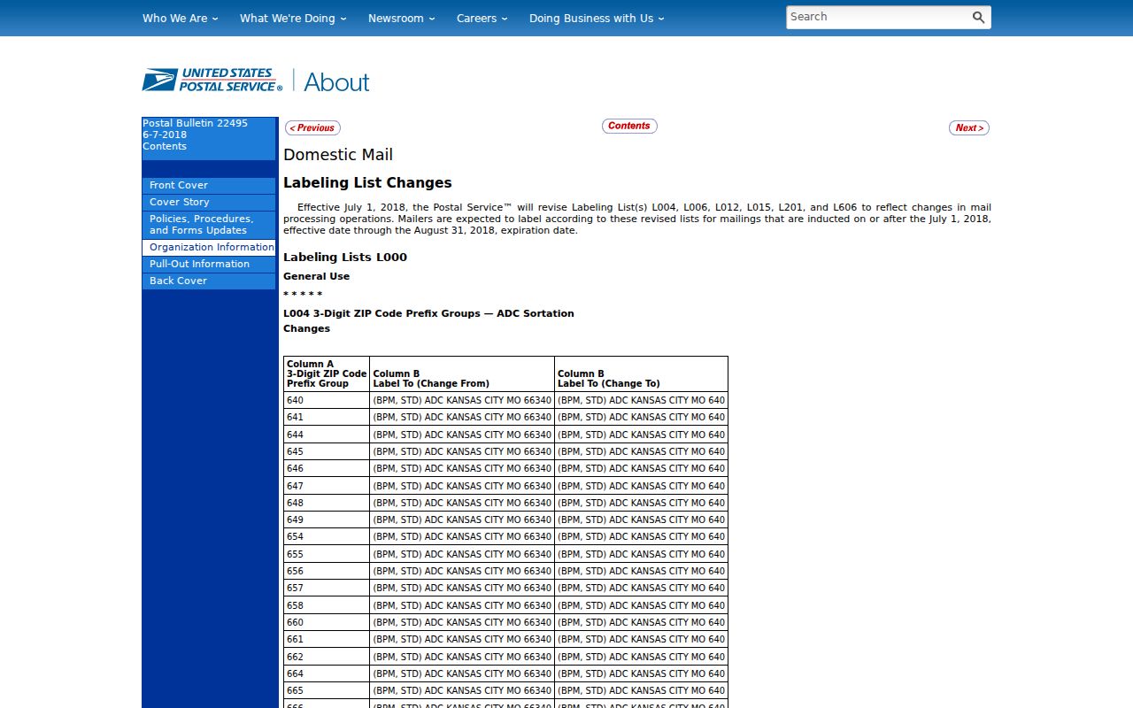
The bulletin is useful for old envelopes and directory addresses, but it is not a parcel boundary map.
Finding Residents by ZIP Code
A ZIP code can narrow a research set, but Greenwich's confirmed public sources do not provide one complete ZIP-only resident list. USPS verifies delivery. The Town Clerk land index accepts a property address without requiring a ZIP as the identity key. The Assessor routes much of its parcel information through the counter, phone, field-card, and street-report channels. GIS supplies maps, data, and abutter products through forms. Use each source for what it actually records.
- Normalize the street name and house number, keeping Cos Cob, Byram, Glenville, Old Greenwich, or Riverside as a separate community note.
- Test the full address and city or state through the USPS ZIP Code Lookup.
- Search the Town Clerk land portal by Property Address and compare the legal description, book/page, document number, and recorded date.
- Use the Assessor phone or counter route and Greenwich GIS map, data, or abutter request to match the parcel and its dated geography.
- If a voter question is legitimate and personal, use MyVote or the registrars rather than requesting the restricted statewide file.
- For a historical entry, search the village and street spelling in Library directories or maps before assigning a modern ZIP.
Once a ZIP narrows the address set, the Greenwich street directory handles the street-level record chain. Keep the ZIP as a delivery clue, not as proof of who lives at a location.
The USPS city and state lookup is the manifest source for current delivery verification.
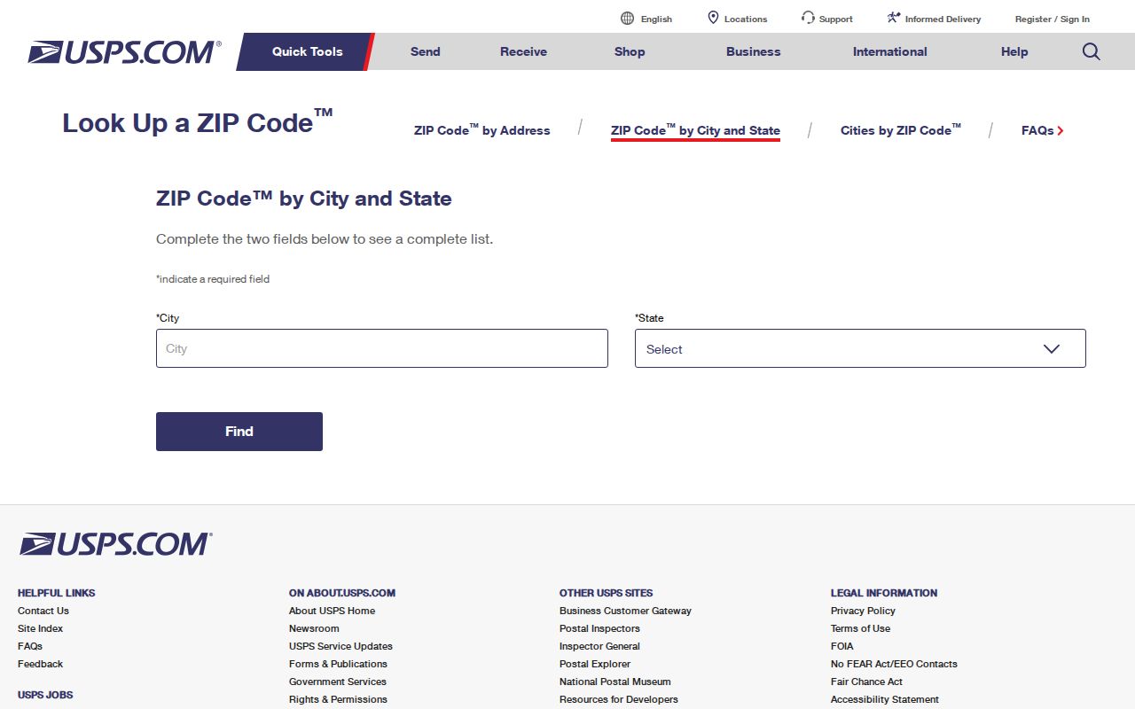
The USPS screen belongs at the start of the ZIP check, before a parcel or historical record is labeled with a current delivery code.
Greenwich ZIP Code Property Search Fields
The official Greenwich MyTaxBill portal is useful property and tax context, but it is not an Assessor map and the inspected page did not confirm a ZIP-only resident filter. Its search modes can help match a property number, account, bill, or name before a Town record check. The portal says municipal records prevail and users should verify information.
| Search Mode | Fields and Notes |
|---|---|
| Last name, first initial, or business name | No comma; case-insensitive; “last first”; returns all bill types. |
| Property number or property name | Property number first; omit street type; real-estate and personal-property context. |
| Bill number | Bill year, bill type, and bill number. |
| Account number | Real-estate or personal-property account. |
| Link number | Link year, type, and number; motor-vehicle or supplemental options. |
| Tax ID via bill number | Grand List year, bill type, and Tax ID. |
| Account ID, Link ID, or DBA | Additional account and business-name filters. |
| Result filters | All, Due Now, Balance Due, and the inspected IRS Payment Records 2025 option. |
| Bill types | Real Estate, Personal Property, Motor Vehicle, Motor Vehicle Supplemental, and Sewer Assessment. |
The MyTaxBill search page can support an address or account match, but an online balance or bill result does not establish occupancy, title, or the boundary of a ZIP code.
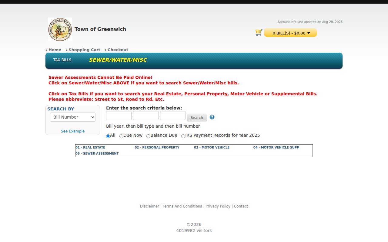
The tax portal shows why account context and postal geography should be joined only after each source's role is understood.
ZIP Codes Versus Greenwich Town Lines
“Greenwich” can mean the legal Town, central or downtown Greenwich, the postal city, or a mailing label used for an address in a wider community. Cos Cob, Riverside, North Mianus, Glenville, Pemberwick, Old Greenwich, and Byram are community labels within the Town's geography. A record can therefore be legally Greenwich, socially Riverside, and postally 06878. ZIP codes do not define voting districts, school attendance areas, police beats, zoning districts, sewer boundaries, or GIS abutter radii.
The Town's public material does not expose one comprehensive current ZIP boundary layer. The survey provides frequency evidence, school and polling documents provide service-address examples, USPS verifies delivery, and GIS can provide a dated map or data product. The GIS request form warns that its database and aerial imagery have their own dates and are updated periodically. P&Z assigns street numbers and coordinates with USPS and emergency services, so an address-number question may belong with P&Z even when the ZIP is known.
The Greenwich polling locations page supplies official service-address examples rather than a ZIP boundary.
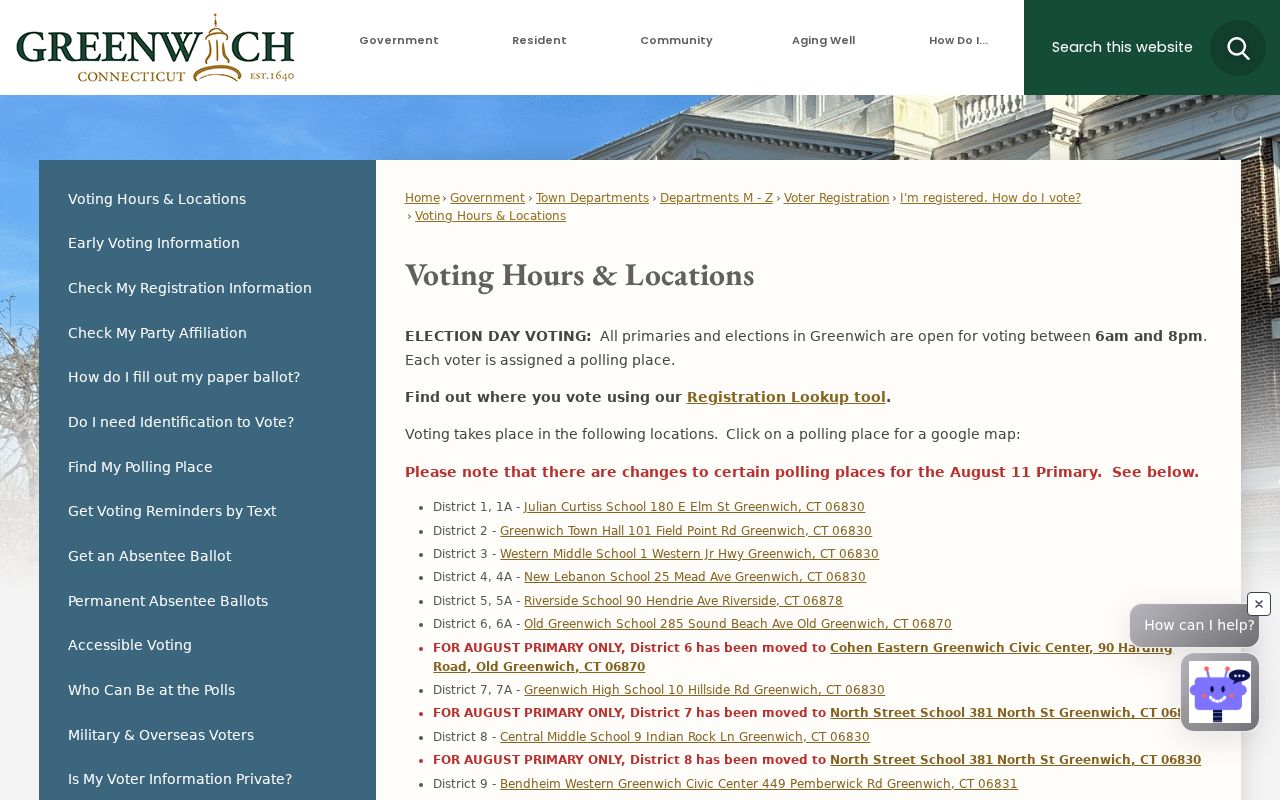
Polling addresses show the practical difference between service geography and postal geography in Greenwich.
- ZIP versus ZIP+4
- The five-digit ZIP identifies a postal area; the extra four digits narrow delivery to a segment or address range.
- PO-box ZIP
- A code used for PO Box or institutional routing. It may not describe a street delivery area.
- Unique ZIP
- A postal code assigned to one organization or institution. Greenwich research does not identify 06836 as a sixth residential code.
- Carrier route
- A USPS delivery path within a postal area. It is not a town, village, parcel, or voting boundary.
For every ZIP-keyed result, capture the legal town, community label, USPS delivery ZIP, and parcel or street identifier. If the source uses 06836, mark it as PO Box, institutional, or legacy until the address custodian confirms otherwise.