
Walk the Greenwich Street Directory
An address-first search works best when each source answers one narrow question. The Greenwich Town Clerk land-record system can connect a street string to a recorded party or instrument, while the Assessor and GIS office add parcel and map context. Neither one should be treated as a current household roll. Start with the address in hand, preserve its spelling, and record the date of every result. The advanced land-record search is useful once the basic address has been normalized.
- Write the current number and street name, then test a full road type and its common abbreviation. Keep a village label such as Cos Cob or Riverside as a separate note.
- Ask the Greenwich Assessor for the field-card, Grand List, or street-report details that tie the address to a parcel, owner, lot size, assessment, or transfer reference.
- Place the parcel in Greenwich GIS and request the map or abutter product that fits the question. Treat the map as spatial context, not as proof of title.
- Search the Town Clerk index by property address, then by separate grantor and grantee names, dates, book, page, document type, and remarks. Open the instrument before drawing a conclusion.
- Add the individual voter route, permit or environmental files, and Greenwich Library's dated directories only when the question calls for civic, project, or historical household context.
This order moves from a place to a parcel, from a parcel to a legal record, and only then to a dated name clue. A grantor may be a former owner, trustee, lender, attorney, or entity representative. An Assessor owner field and a deed party are not the same as an occupant. A directory line can describe a householder, boarder, business, or phone subscriber from that year. That distinction keeps a Greenwich street directory useful without turning a role in one record into a claim about a whole household.
Greenwich Street Numbers Begin at P&Z
Planning and Zoning assigns Greenwich street numbers and coordinates with USPS and emergency services. The Town's street-number application page says one number is assigned for each improved lot, and an applicant needs a plot plan or survey. Processing can take a week or more. The assigned number must be displayed at least two inches high and visible from a vehicle traveling in either direction. Multiple-unit properties have additional requirements, so an old directory number should not be assumed to be the current identifier.
The same page gives a practical service route for a number that is missing, newly assigned, or hard to reconcile with a parcel. Planning and Zoning guidance is listed from 8:00 a.m. to 3:30 p.m., with professional assistance from 1:00 to 3:30 p.m. The page also states a $25-per-month charge for noncompliance with the display rule. That is an address-sign enforcement detail, not evidence that every older number was displayed or that a historic source used today's numbering.
The manifest capture of the Greenwich street-number application route shows the municipal starting point for a new or changed address.
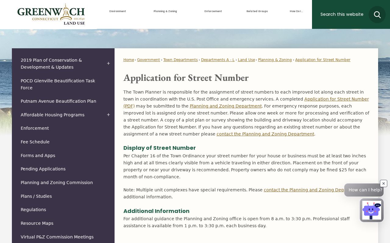
The page connects the number to a lot and to the Town's review chain, which is why it belongs near the start of an address search.
Greenwich Address Search Fields Matter
Greenwich records do not all normalize an address the same way. Town pages use both “Field Point” and “Fieldpoint” in different contexts. Old Greenwich is a community label within the Town, while Cos Cob, Mianus, Riverside, Glenville, and Byram can appear as village or neighborhood terms in directories and current pages. Try Road and Rd, Street and St, or Avenue and Av, but keep the original string in the research notes.
The IWWA tip sheet is especially clear about search behavior. Its Street Name field uses a dropdown, street names may be abbreviated, and Street Number may be blank or a lot number. A Last Name search can identify an owner, agent, or contractor and may need a wildcard for a broad result. The First Name field is described as containing no information, so it should not be used as a shortcut. These are field rules, not guesses about what a search form ought to accept.
| Field or clue | Greenwich search practice | What to preserve |
|---|---|---|
| Property Address | Use in the Town Clerk land search and related property records. | Compare the indexed address with the deed's legal description. |
| Street Name | Use the IWWA dropdown and test abbreviated names. | Keep the selected spelling and any former name. |
| Street Number | Try the house number, a blank value, or a lot number where the tip sheet allows it. | Do not turn a lot number into a house number. |
| Last Name | May match an owner, agent, or contractor; a wildcard broadens the search. | Record the role shown by the file. |
| Parcel or tax ID | Test the documented formats, including variants with letters or a suffix. | Copy the ID exactly before joining records. |
| Date and source status | Use recorded or application dates and note the portal certification date. | A current index date does not make an old result current. |
Note: A search that fails under one street spelling can still succeed after the village label, road type, lot number, or historic name is separated.
Greenwich Address Record Sets
A Greenwich by-address trail is a set of linked records, not a single database. The Town Clerk holds legal instruments. The Assessor maintains a tax snapshot and field-card route. GIS supplies layers and request products. Voter information has its own public scope and privacy rules. IWWA and building files describe projects, applications, and permits. The table below keeps those roles apart while showing how an address search can move between them.
| Record set | Keeper | Street-level use | Access route |
|---|---|---|---|
| Land records | Greenwich Town Clerk | Party role, property address, instrument, book/page, document date, and linked image. | Publicsearch online; Town Clerk vault, counter, or mail for recorded documents. |
| Assessor files and street reports | Greenwich Assessor | Owner, parcel, lot size, assessment, transfer volume/page, and Grand List context. | Counter binders and public terminals; phone, email, mail, field-card, and file requests. No public web parcel search was located. |
| GIS maps and abutters | Greenwich GIS | Parcel geometry, roads, buildings, zoning and environmental layers, and abutting-property choices. | Resource maps, map/abutter/data forms, walk-in or appointment service, and digital or USB delivery. |
| Voter registration | Greenwich registrars and Connecticut Secretary of the State | Individual registration or polling context, within the public scope allowed by state law. | MyVote lookup, registrars, or a restricted written file request. No block roster was located. |
| IWWA applications | Greenwich Inland Wetlands and Watercourses Agency | Address, owner, agent, contractor, parcel, map, soil, permit, or correspondence clues for projects. | Online applications from 1973-2014; later files are held by the Wetlands office. |
| Building and street records | Building Inspections and Planning and Zoning | Permit or inspection status, Certificate-of-Occupancy conditions, street numbers, names, and plans. | City Squared for the confirmed online features; record room, counter, email, or FOI for other files. |
The advanced land-record screen is the most detailed online address path. The capture linked from the manifest shows separate party, grantor, grantee, date, document, book/page, remarks, property-address, and document-image phrase filters. Use the index to locate a result, then inspect the image and record its instrument number. For the historical directory shelf and the way older street guides are read, use the Greenwich city directory collections rather than treating a current parcel route as a substitute.
The manifest capture of the Greenwich advanced land-record search makes the separate party and property fields visible.
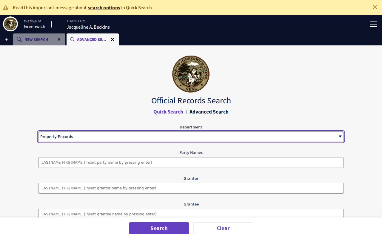
Those fields support repeatable address research, but the result still needs a date, document role, and image check.
Greenwich GIS Shows Parcels and Abutters
Greenwich GIS is a layer system, not a title vault. The official office describes public maps, abutter lists, data files, and staff help. Its legend includes property lines, roads and centerlines, buildings, driveways, hydrology, wetlands, flood zones, contours, cemeteries, utility and cultural features, recreation and marine layers, and land-use categories. A map line can place a street or parcel in context, but it is not necessarily current to the deed or Assessor snapshot.
The GIS map request form asks for a requester, email, property address with building number, street, and ZIP, and a disclaimer acceptance. A phone number and Parcel ID are optional. The form offers 8.5-by-11 or 11-by-17 output and choices for aerial photo and property lines, topographic map, or another request. It says requests received between 8:00 a.m. and 4:00 p.m. are returned by email in one to two business days. The form dates its map database to October 1, 2022 and aerial imagery to April 2022, and warns that layers are updated periodically.
The manifest capture of the Greenwich GIS address map request shows the fields used to tie a map product to a street.
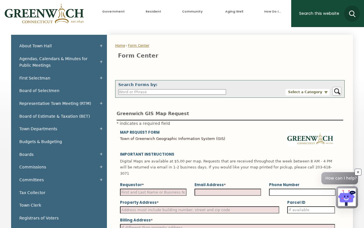
The Town also links an interactive zoning map through its GIS resources. Research did not expose a confirmed live parcel-click result, current imagery layer list, or neighboring-owner display, so those details should be checked at the source before being quoted.
Note: GIS can show the shape and setting of a parcel, while the Town Clerk and Assessor answer different questions about documents, assessment, and recorded roles.
When Greenwich Streets Change Names
Old and new street names can remain in Greenwich records at the same time. The Town's Street Name Change petition records the proposed name, public or private status, beginning and ending points, intersecting streets, length, signatures, and an affidavit filed with the Town Clerk. Public streets require a majority petition from abutting owners, review by Planning and Zoning, Highway, Police, and Fire, action by the Board of Selectmen, and final Representative Town Meeting approval. A private street follows a different P&Z route. After a change, owners are responsible for notifying interested parties.
Create a continuity note before searching a renamed road. Keep the old name, new name, petition date, intersections, public or private status, and any Town Clerk affidavit together. Then run both names through land records, IWWA, directories, maps, and tax or Assessor material. The same practice helps with Field Point and Fieldpoint, village names, road-type abbreviations, unit suffixes, and a ZIP that changed while the street remained in place.
- Parcel
- A mapped or taxable piece of land. It can contain a structure or several units, so it is not automatically a household.
- Situs address
- The physical location assigned to a property, which can differ from a mailing address or a tax-bill address.
- Plat
- A recorded or planning drawing that shows lots, roads, boundaries, or subdivision layout.
- Criss-cross directory
- A historical reverse directory organized around an address, phone, or street clue. It can identify a dated householder or business, not a current resident.
Greenwich Environmental Files by Address
The IWWA Application Search is a distinct address trail. Its online set covers 1973-2014 and contains more than 5,000 files that may include maps, soil reports, permits, and correspondence. The official IWWA property-search tip sheet, revised March 24, 2026, says to search by application number, street address, owner, or parcel/tax ID. Application numbers use an XXXX-XXX pattern, and a query such as 2001* can cover a full year.
Use the Street Name dropdown, test the documented parcel formats, and choose FILE, MAP, or both. A last-name hit may describe an owner, agent, or contractor. It does not establish who lived at the address. Subsequent applications are held in the Wetlands office, so the online date range is a boundary to mark in the notes rather than a promise that no later file exists.
The manifest capture of the Greenwich IWWA property application search illustrates the environmental route used for an address.
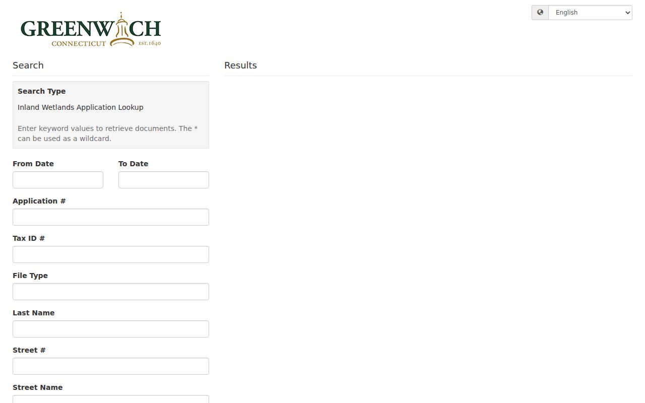
The application number, address, owner or agent role, parcel, and file type should be copied with the result so a later office request can target the same record.
Permit Records Follow Their Own Greenwich Route
Building Inspections moved permit and inspection status to City Squared. The Town says the service is free, available around the clock, and can show real-time permit and inspection information, application status, inspection results, and permit or Certificate-of-Occupancy conditions. It requires an account, registration, or claim flow. A permit number for electrical, plumbing, or HVAC work associated with a building permit is searched without the E, P, or H suffix. Foundation permits use an F suffix, while trade-only permits use their own number.
The research pass confirmed the Town's features but did not expose the public City Squared URL or live field labels. That gap matters. Use the official Greenwich Building Inspections page for the confirmed route, and use the building or permit-record room, P&Z, email, or a narrowly described FOI request when an older or later file is not visible online. A permit names an applicant, owner, contractor, or project role for a date. It does not by itself establish a resident.
The manifest capture of the Greenwich building permit and inspection route shows the official starting point for a project-history search.
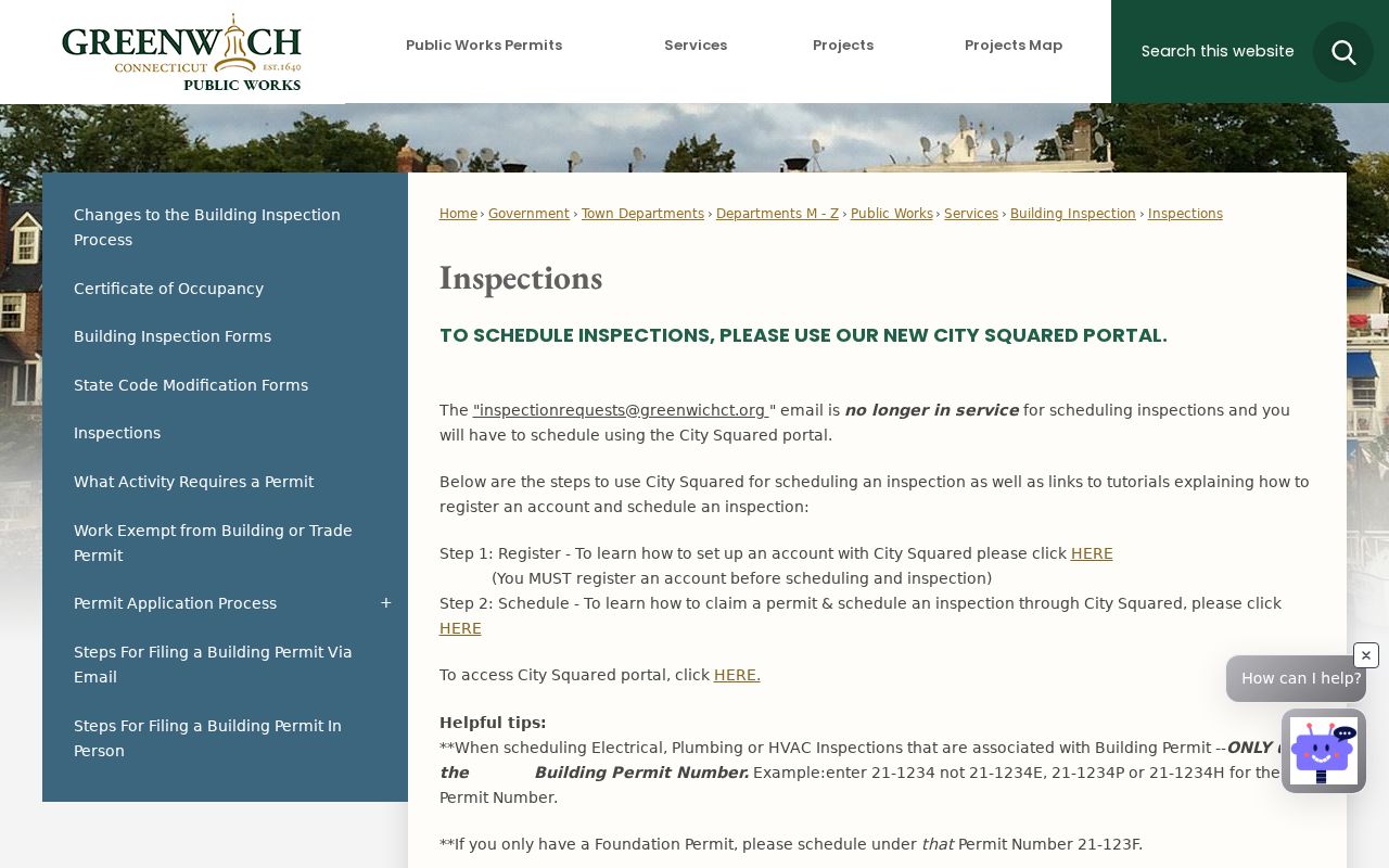
Keep the permit number, project date, and named role with the street record, then confirm any parcel claim through the Town Clerk or Assessor.
Greenwich Neighborhoods, ZIPs, and Old Maps
A Greenwich street can be legally in the Town, socially identified as Byram, Cos Cob, Glenville, Old Greenwich, Riverside, or another community, and postally assigned a different label. Current Town material identifies five residential delivery ZIPs: 06807, 06830, 06831, 06870, and 06878. The 06836 code is a PO Box or institutional special case associated with Town Hall and should not be treated as a sixth residential ZIP. Validate delivery through the USPS ZIP Code Lookup, then keep the legal town, community label, ZIP, and parcel identifier as separate fields.
Older street work needs the same care. Greenwich Library's map list includes the 1869 Town map with owners, villages, school districts, and roads, plus later topographic maps and 1893 and 1931 atlases. Those maps can explain an old road name or owner label, but they are not current title records. A directory line should be dated and checked against a deed, map, or other custodian. The Town's 2026 paving notice, updated August 11, 2026, is another dated street clue, moving generally west to east from Byram toward Old Greenwich without establishing ownership or occupancy.
Note: Postal geography, village identity, legal town, polling area, and GIS distance are separate address clues and should not be collapsed into one label.
What a Greenwich Street Directory Cannot Establish
A deed can show a grantor, grantee, trustee, lender, release party, or entity. An Assessor card can show an owner, assessment, transfer reference, or mailing detail at its stated date. GIS can show a line or layer. A voter record can show only the information released under Connecticut rules, and the public MyVote screen was not captured during research. None of these sources proves every person who occupies a building, every household member, or a private phone or delivery record.
Connecticut's Address Confidentiality Program, voter privacy process, FOI exemptions, vital-record rules, DMV limits, and law-enforcement protections can restrict or redact an address. The Address Confidentiality Program uses a substitute address for qualifying protected participants. The voter privacy program has its own affidavit route. A records request should ask for the minimum needed field and preserve the source date, not attempt to reconstruct a protected person's location.
Lawful use. Greenwich street and address records support personal, lawful research, family history, property history, and civic curiosity. Do not use a name or address to stalk, harass, intimidate, surveil, or publish protected personal data.